At LandHawk we are always trying to source or create the highest accuracy data to improve the reliability of a land development professional’s decision making.
There are different types of ‘top-down’ imagery that are available for the UK, at different resolutions, currency and coverage. There are also varying costs associated with deploying these through applications, like LandHawk.
Some of the options out there are:
- Drone Aerial Imagery (high resolution, medium cost, small coverage)
- Aerial Imagery from light aircraft (high resolution, high cost, UK coverage)
- Satellite imagery (varying resolutions, varying cost, global coverage)
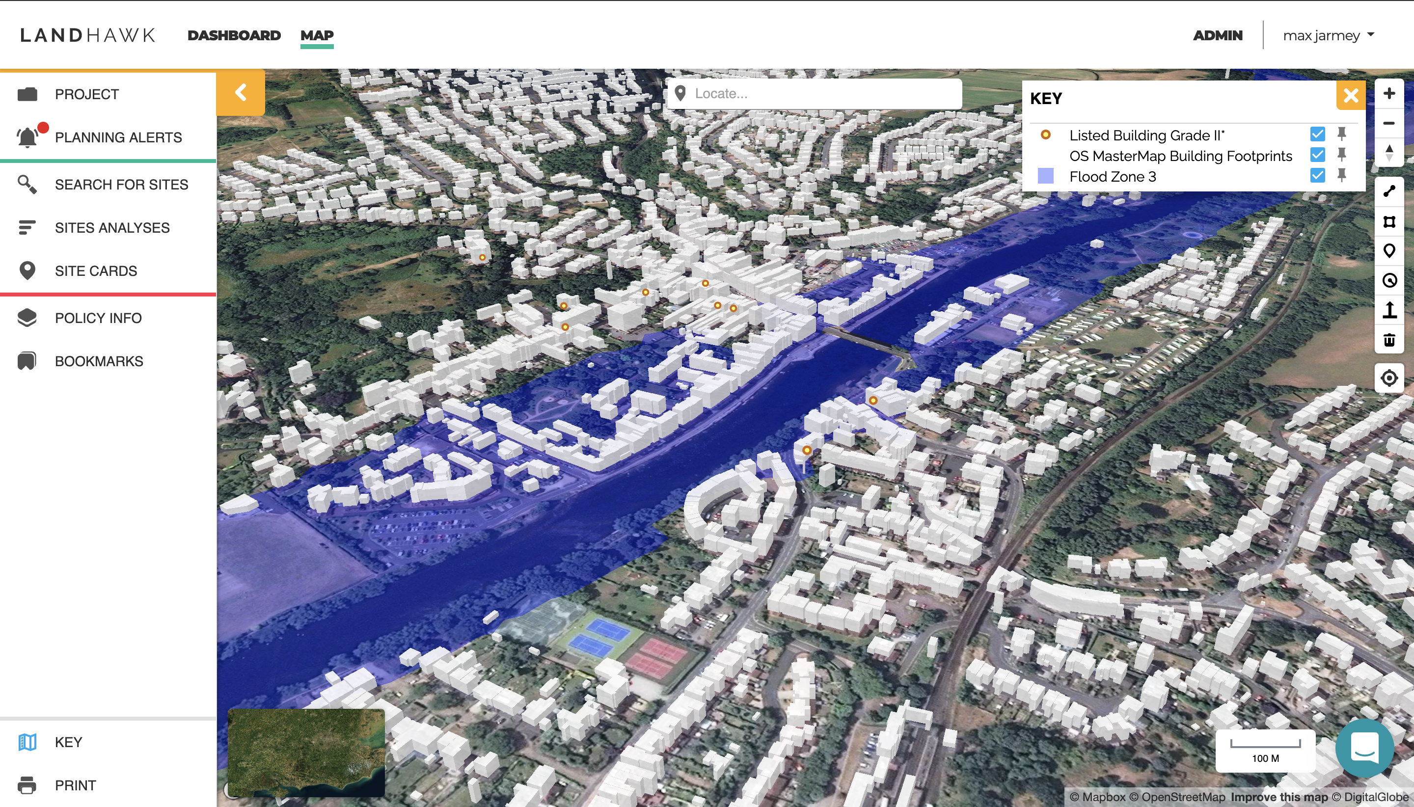
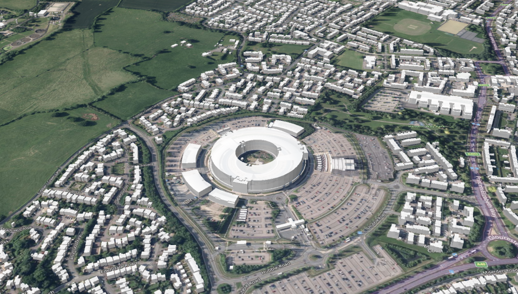
We are happy to announce that we have updated our aerial imagery base maps for the UK. You will notice there is a vast improvement in quality and currency from what LandHawk had originally, which will improve the reliability of your decision making. The aerial imagery base map complements the Ordnance Survey base map options nicely, giving you the option to change the flavour of the map to suit the type of data you are overlaying. The resolution for our aerial imagery is among the best available at 60 cm – 30 cm/pixel resolution.
As well as base maps, we are testing UK terrain height data. We have analysed and extracted the slope of the ground to identify potential incline issues to improve the accuracy of your land assessment. I’ll announce that as soon as they are ready to roll!
If you have any questions about this update, any ideas or would like a product demonstration, please just get in touch or fill out our new feedback and ideas form, here.
Max
Product Owner, LandHawk