Last year, over 351,000 planning applications were granted in the United Kingdom alone. Almost 3 million units have been granted in the last decade. This equates to a huge amount of data spread across hundreds of different Local Planning Authorities, each with its own reference system to contend with.
At LandHawk, we strive for improved location accuracy within our data. By focusing on this key area, it allows rapid identification of any applications of interest, significantly speeding up the decision making process.
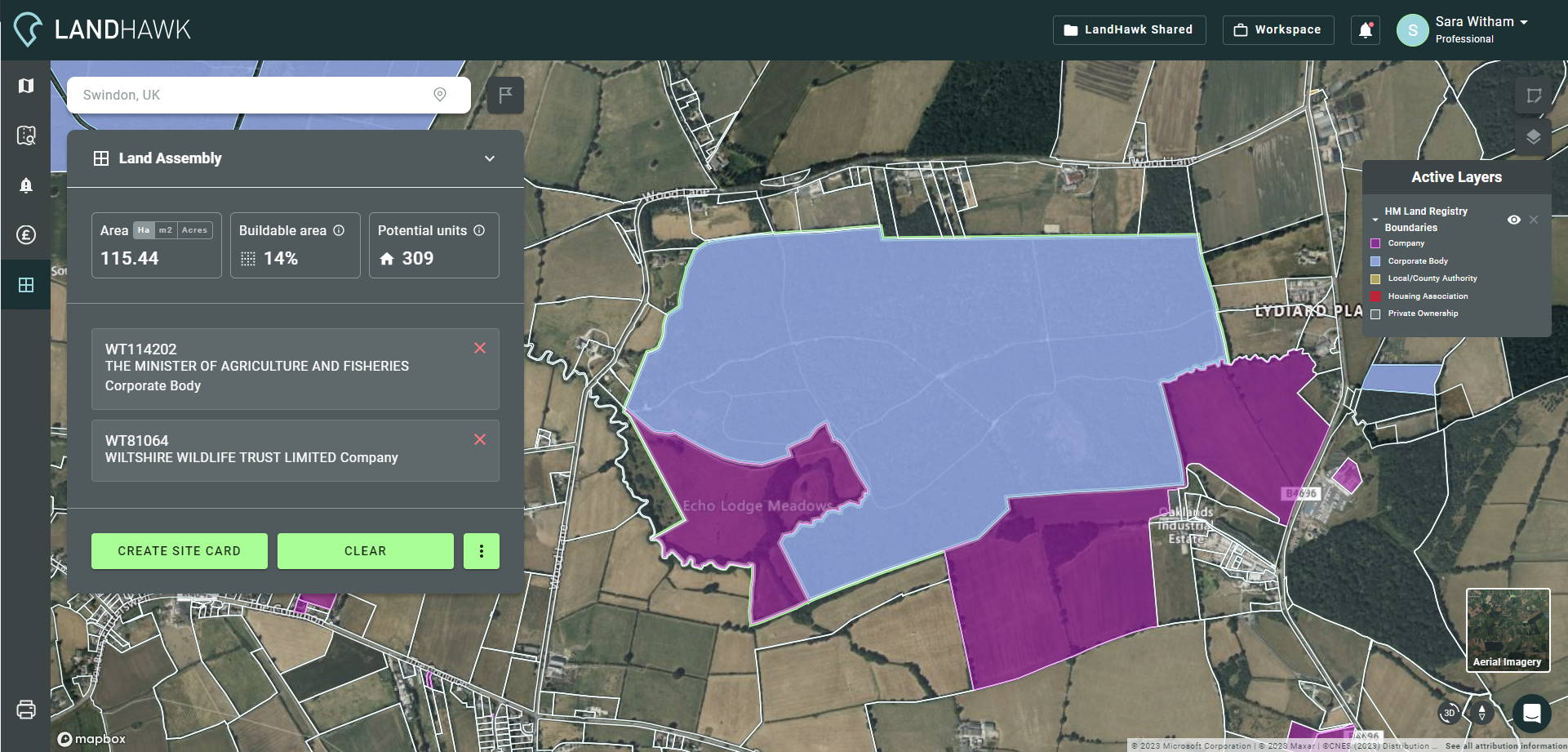
That is why we created our custom LandHawk data platform. It drastically improves the way data is delivered and analysed, and we believe it will revolutionise your ways of working. Our goal has been to create a platform that could be trusted and used effectively, offering real change to our industry. By using our combined expertise in data science, we have created the definitive source of planning data.
Through rigorous testing and development, we have seen real-world results that improve the accuracy and number of correctly positioned applications. This is a huge benefit to our users, providing more details and allowing you to find the applications you need quickly and with confidence.
Planning application data enhancements
Recently, we have undertaken a programme to enhance our Planning Application Data for the LandHawk platform. The output now allows users access to more information and improved geolocation of planning applications across the UK. This will speed up land appraisals and vastly improve the reliability of decision making. Here are some of the enhancements:
Site Location – By refactoring our geocoding (address to map location) algorithm, we are able to find and accurately locate ambiguous addresses. For example, if you search for ‘639 Mansfield Road, Nottingham NG5 2FX’ on Google, AA route finder, RAC route finder or OpenStreetMap, the point appears in the wrong place. Our refactored algorithm locates this and many of the other ambiguous addresses correctly and provides the UPRN for the planning application wherever possible.
Planning Agent – We can now provide information about the company or agent working on behalf of the applicant (if applicable). This information may include, but is not limited to, the company name, appeal, decision, current appeal status and type, plus dates relating to them.
Public Comments – If public comments are recorded on the application, we can now provide the web address for these, as well as the comments provided.
Consultation – The consultation start and end dates are now available where recorded.
Advanced Planning Determination Information – The date the application was received, the date it was deemed valid, who it was validated by, the date of determination and the date it was published are all now available.
Improved Planning Decision Information – The date the decision was made, date it was issued, date it was published and the development type mentioned in the proposal are now available.
In addition, we now provide over 50 key pieces of information, including:
- Dates of advertisement of the planning application
- Number of constraints placed on the application
- Number of comments made on the application
- Number of documents associated with this application
- Number of housing units associated with the application
What does this new data mean for you?
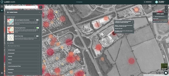
These improvements translate into more powerful tools for you to harness within LandHawk, including our new Site Finder tool (coming soon) and data API packages. This tool is only possible thanks to the Planning Application Data enhancements made available through LandHawk. It will enable you to run powerful searches for new development opportunities and land strategies based on your specific criteria.
Let’s take a look at a real-life example. Here is the search criteria:
- Size – sites with approved outline planning for 50+ units
- Time – have not progressed over the last 2 years
- Intent – intercept the application and take it through full planning and development
Our new Site Finder tool enables you to find the sites matching your requirements in a matter of seconds. Not only that, but it also analyses all the search results for planning constraint risks.
Further Search Enhancements
Our new and improved range of decision dates allows you to filter out planning applications made during certain periods. This speeds up the process of searching or tracking applications of interest.
These enhancements also improve our ability to provide accurate planning alerts on specific dates of decision. You could be the first to receive updates and new decisions made within your area in near real-time, allowing you to react quicker than your competitors. This feature will come with the release of our new planning alerts tool.
All of the key planning information that you can access on our platform is vital to unleashing the full potential of your future projects, as well as gaining important insights into reasons for refusal.
At LandHawk, we understand that locating and dissecting this information can be overwhelming. That is why we are working hard to make this data readily available, easy to digest and analyse through our intelligent web app.
We can’t wait to see what you achieve with these new tools and we’d love to hear your feedback.
Try the LandHawk software now or contact us to get access to our range of data API packages that are geospatial ready for your mapping applications.